

The Rocks That Named Calvados

This post is for the history buffs among you who may be curious about how the department of Calvados, where Eco-Gîtes of Lénault is located, acquired its name and what it might have otherwise have been called.
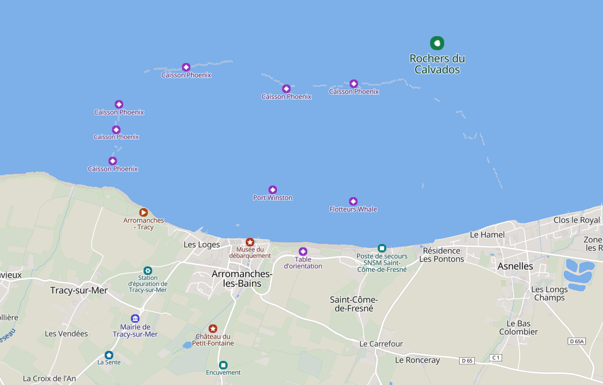
Before the French Revolution, France was divided into historic provinces such as Normandy, along with a confusing patchwork of church, parliamentary and tax regions. In 1790, this system was swept away and replaced by the departments we know today. For Calvados, names such as Orne-Inférieure and Basse-Orne were initially proposed, but in the end the department was named after a group of offshore rocks known as the rochers du Calvados, near Arromanches.
Map source: Mapcarta
So where did the rocks themselves get their name?
One old legend claims that a ship from the Spanish Armada, called El Salvador, was wrecked on the rocks in the 16th century, eventually giving rise to the name “Calvados.” Historians, however, generally dismiss this story because there is no evidence of such a shipwreck.
The explanation most widely accepted today comes from René Lepelley, a professor at the University of Caen, who suggested in 1990 that the name derives from the Latin calva dorsa or calva dossa, meaning “bare backs.” Early nautical charts were written in Latin, and the term referred to two rocky outcrops visible from the sea, bare of vegetation and used as landmarks by sailors. The French word dos (“back”) also comes from the same Latin root.
Today this stretch of coastline is perhaps better known as Gold Beach, at the heart of the D-Day landing beaches. Visitors to Arromanches can still see the remains of the artificial Mulberry Harbour, visit the 360° Cinema, the D-Day 75 Garden and the recently refurbished D-Day Museum.
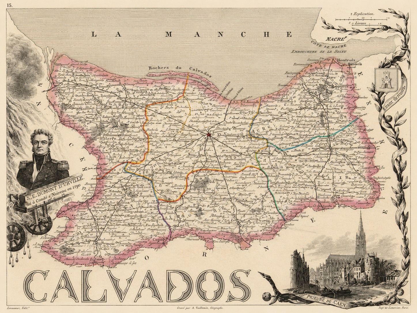
Early 18th century engraved map of Calvados by Alexandre Vuillemin. Source Outrouverquoiacaen on Facebook.
You can also see on this early map mention of the explorer Jules Dumond d'Urville. He was born in Condé-sur-Noireau, in 1790, just after Calvados came into being. He was am explorer and naval officer whose voyages took him to the south and western Pacific, Australia, New Zealand and Antarctica. He was also a botanist and cartographer giving his name to several seaweeds, plants and shrubs and to places such as d'Urville Island in New Zealand. The secondary school on Condé bears his name and his statue stands near the church in the centre of the town.
At the time this map was created, Lénault had reached its peak population of 689 inhabitants, and it was around this period that our house/gite was built. Sadly, it was still too small to earn a place on the map (all the surrounding villages made the cut), but we’ll forgive the engraver, Alexandre Vuillemin, for leaving us out, as he produced such a wonderful record of the newly created Calvados.
It is difficult to imagine our department being called anything other than Calvados and thanks to a few rocks off the coast, we were spared the rather less inspiring names of Orne-Inférieure or Basse-Orne.
If this bit of history has inspired you to explore our corner of Normandy, we’d love to welcome you to Eco-Gites of Lénault. Come and discover the landscapes, stories and quiet charm of Calvados for yourself.
Comments
Stayed in Arromanches and found all the exhibits fascinating. Thanks for the history lesson on the Calvados.
Becky McHughAn incredibly interesting and informative read! I wasn't aware of this history and how the name Calvados came about, really eye opening. Another excellent blog post!
CarrieThat's a lovely piece of history of the origins of the areas. I guess all the regions and departments have some interesting naming history. I think I'm right in saying Languedoc comes from the language of the Occitain people.
Geoff KiddThanks for that interesting history. Didn't realise it was the rocks! Thought it was the liquor!!! Apple brandy- Calvados!
Jillian HIBBERDOh, I didn't know that and I lived in Calvados for many years, thank you for enlightening me. I agree about Arromanches, very interesting place.
SueCavados is definitely much more poetic and inspiring than low Orne or inferior Orne!
Phoebe